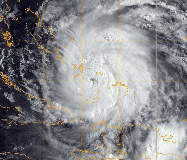
110824-O-ZZ999-001
CARIBBEAN SEA (Aug. 24, 2011)
A GOES-13 infrared satellite image provided by the U.S. Naval Research Laboratory, Monterey, Calif., showing the status of Hurricane Irene at approximately 6 a.m. EST Wednesday, Aug. 24. Irene crossed over the Bahamas with 115-miles-per-hour winds. The storm could strike the U.S. East Coast between Florida and the Carolinas as a Category 3 hurricane. (U.S. Navy photo/Released)